Bring GPX from anything
GPX is the plain-text lingua franca of GPS. A Wahoo head unit, OsmAnd, Organic Maps, AllTrails, Runkeeper, a handheld in a drawer — if it writes GPX, it works here, and you do not need to convert anything first.
Versions
GPX 1.0 and 1.1, any namespace
Upload
One file, many files, or a .zip of them
Timestamps
Nice to have, not required
Big files
Streamed — a 10 MB track is fine
- 01
Find the export in your app — it is nearly always called GPX
Almost every app puts it behind a share or overflow control on the activity or route itself. OsmAnd and Organic Maps: export or share the track from My Places. AllTrails: the recording's own page, on the website. Runkeeper: the activity page, also on the website. A bike computer or a handheld: plug it in with a cable and look for the GPX folder on the device — a Wahoo or a Garmin Edge mounts as a disk. Strava, Garmin Connect and komoot have guides of their own on this site.
⋯Export GPX
This may have moved. Every app words this slightly differently and they all reshuffle their menus. Look for the letters GPX rather than a specific phrase.
The overflow (⋯) menu on a saved activity
ShareExport GPXDownload GPXsame thing, other appsSave as fileDuplicateDiagramDiagram — the shape this menu takes in most apps. - 02
No app of your own? Take one from OpenStreetMap
OpenStreetMap's public trace list is genuinely public — no account needed to look — and every entry is a real GPX file with a real point count. It is the easiest way to see what a valid file looks like, or to try Maps of You before you go hunting through your own accounts.
openstreetmap.org/traces
Public traces are other people's journeys, released under the ODbL. Fine for a test; not something to print and hang.
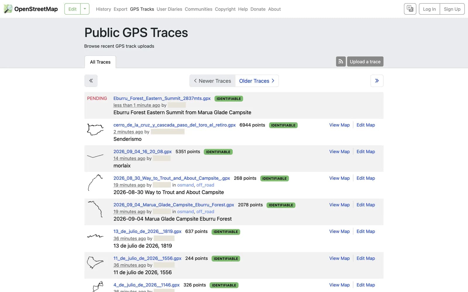
Screenshotopenstreetmap.org/traces signed out, captured 7 September 2026. Uploader names are painted over. - 03
Drop the files in — all of them, at once
The importer takes a single file, a folder's worth, or a zip. There is no need to sort them by trip or by year first; we group everything by country and region on the other side.
Import your travelsGPXDrag your export here, or click to choose files
inside a .gpx<trk>a track<trkseg>→ one journey each<trkpt lat lon>the geometry<time>optional<ele>optional<rte>a planned route — also read<wpt>a waypoint — becomes a stopDiagramDiagram — the parts of a GPX file we actually read. - 04
Check the review map, then design
Every journey lands on a review map before anything reaches a poster. Throw out the commute you recorded by accident, keep the fortnight in the mountains, and go to the studio.
ReviewDesign poster
What we do with the file
So you know what survives the trip from their servers to your wall.
- Each <trkseg> becomes its own journey, so a track paused overnight does not draw a straight line across the map.
- Attribute order does not matter: Garmin writes lon before lat, which is legal, and we read attributes by name rather than position.
- Files with no <time> import happily. You keep the geometry and lose only the time-based statistics; we flag it rather than failing.
- Single-point segments and points with impossible coordinates are dropped with a note on the import, not silently. Wholly empty segments — the gap a device leaves when you pause — hold nothing to report, so those go quietly.
- A UTF-8 byte-order mark, a prefixed namespace like g:trkpt, and GPX 1.0's older namespace are all handled.
When it goes wrong
Where this trips people up, and what to do about each.
Got the file? That is the hard part done.
Drop it in and we draw the ground you covered — the forest, the crop, the rock, the relief of the hills — with your line on top. Nothing you upload is public, and you can delete any of it at any time.